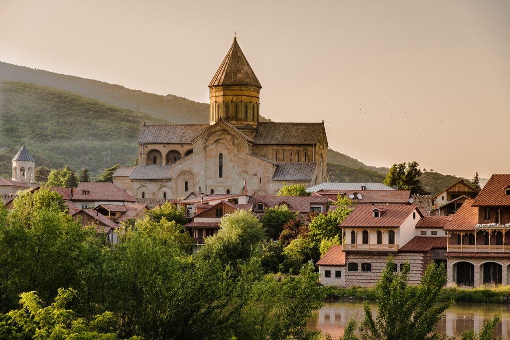
Die Wanderung in Georgien (Swanetien) war unser absolutes Highlight. Trotz des mittelgrossen Zwischenfalls, haben wir es total genossen und würden uns sofort wieder aufmachen, um diese wunderbaren Tage noch einmal erleben zu dürfen.
Wir würden die Wanderung auf jeden Fall, jedem weiterempfehlen.
Mehr: 5 Videos aus Georgien
Showing posts with label Trekking. Show all posts
Showing posts with label Trekking. Show all posts
Wednesday, August 21, 2019


Saturday, January 18, 2014
KAUKASUS REISEN: Sicherheit - Wie sicher ist Chewsuretien ? (kaukasus-reisen.de)
 (kaukasus-reisen.de) Das Reisen in Georgien und in der historischen Bergregion Chewsuretien ist sehr sicher. Die Grenze nach Russland trennen hohe Berge und die natürlichen Zugänge über Pässe oder Täler werden von der nach Vorbild des Bundesgrenzschutzes aufgebauten Georgischen Grenzpolizei und auf der russischen Seite von Russischen Grenztruppen zuverlässig bewacht.
Die Infrastruktur entspricht nicht der der Alpen. Die Wanderwege sind eher schmale Pfade und es existieren keine Berghütten oder Unterstände. Die Wanderetappen gehen von Dorf zu Dorf.
Dabei geht es zum Teil über steinige Strecken, durch matschig-ausgetretene Kuhpfade, durch reißende Bäche und kurze Distanzen über Altschneefelder. Es muss besonders vorsichtig und immer sicher gelaufen werden.
Auf der Reise kommt man oft in Kontakt mit freilaufenden Tieren, wie Pferden, Rindern, Haushunden und seltener auch Wildtieren. Tiere können unvorhersehbar reagieren und man sollte sich vorsichtig und souverän verhalten. Im Zweifelsfalle hören Sie auf die Anweisungen des Guides und bleiben bei der Gruppe.
Unsere Guides und Helfer sind lokale Chewsuren. Das Verhältnis zwischen den Chewsuren und gegenüber Fremden ist freundlich, höflich und manchmal herzlich. Kaukasus-Reisen ist in der Gegend gut bekannt und unsere Gäste werden sehr freundlich aufgenommen.
REISE: Trekking in der Bergwelt von Chewsuretien, 2 Termine im Juli und August 2014 [kaukasus-reisen.de]
Eine 12-Tage-Trekkingtour mit Packpferden durch die Gebirgsregion Chewsuretien (English Version here) (русская версия)
more here: How safe is Georgia ? [quora.com]
Thursday, August 01, 2013


Friday, August 31, 2012
ALPINISM: Mikheil (Misha) Khergiani (1932-1969), a Georgian alpinist. (svanetitrekking.ge)
(svanetitrekking.ge) The major indiginous inhabitants of Svaneti region are Svans, they speak their own original non-written language (dialect) - Svanuri that belongs to the group of Georgian languages (dialects). Svaneti is one of the charming pieces of the multy-ethnic and cultural mozaic of Georgia.
Svans, as well as all Georgian highlanders are well acustomed to the mountain life-style. The increased risk factor, frequent avalanches, mudflows and torrents, landslides, rapidly changing climate conditions, severe winters and etc. require great endurance, shrewdness and skills from the local population. The skills and tools used by highlanders in their daily work are primitive but surprisingly rational. It's an impressive picture watching highlanders sliding huge logs or haystacks down through the curved steep slopes or accompanying a hunter up in the mountains. No wonder that Svaneti raised many high class mountaineers and alpine guides. The best proof for the abovementioned is Mikheil Khergiani!
Mikheil (Misha) Khergiani (1932-1969), a Georgian alpinist, Honoured Master of Sports of the Soviet Union (1963), USSR Master of Sports of International Class (1967), thrice USSR Champion in Alpinism and seven times USSR Champion in wall climbing, a perfect master of mountain and rock climbing. He was the most popular sportsman in the former Soviet Union and beyond its borders. Since 1976 the Khergiani memorial tournament in wall climbing has been established. In 1969 one of the nameless peaks in Turkestan Range was named after Mikheil Khergiani. In 1971 a special Khergiani prise for USSR wall climbing tournament was introduced. In 1978 a small planet N3234 discovered in the solar system was named in Mikheil Khergiani's honour.
Mikheil Khergiani's home-museum is opened in the town of Mestia, where the whole picture of his life is displayed.
Georgian highlanders have been using the Caucasus passes for traveling and transportation since ancient times. They communicated with domestic and neigbouring regions. The most remarkable example of massive movement through the Caucasus passes is the emmigration of the Georgian King Vakhtang VI and his suite, consisting of approximately 1200 nobles, to Russia (in 1724). Their route led from Notsaruli gorge through Gurdzi-Vtseki mountain pass (3400) and Pastagi glacier to the Digoria. The mentioned route still belongs to the most difficult itineraries of mountaineering tours.
It is also noteworthy, that 4100 meters above sea level on the slopes of Mkinvartsveri there is the cave of Bethlehem - the oldest monument of Christianity, the hermits abode.
Georgian folk legends and tales tell about the people who climbed up the mountains in ancient times. According to the legends in XVII century a priest Yoseb Mokheve had even climbed up Mkinvartsveri (5033 meters).
Thursday, August 16, 2012
BLOG: Svaneti, as good as it gets! Text and photo Eistein Guldseth, 2012 (gotocaucasus.com)
 |
| The dramatic nature of Svaneti is dominated by the mighty Mount Ushba with it's caracteristic double-speared summit at 4710 meters. It's regarded as one of the most difficult mountains to climb in the Caucasus. |
(gotocaucasus.com) SVANETI IS THE MOST EXTREME part of Georgia. I have been traveling in Georgia since 2004, but there has always been something stopping me from carrying out my Svaneti trip. One year there was terrible weather, another year the region was seized by Gen. Kvitsianis paramilitary forces. Something has always been in the way. But this year we went, and what a trip it was. But the backdrop was rather tragic:
Four Ukrainian climbers had an accident on Mt. Ushba the week before. Two of them died. During the rescue operation, two Chech climbers who disappeared after an accident in 1974 were also found.
How to get there
From Tbilisi you drive to Zugdidi, and take the road to Mestia wich is the centre of Svaneti. It is about 130 kms drive. No need for any 4WD. But beware of falling rocks when its raining. You can also go by plane, as the city has a small airport. But it's not Mestia you want to see. That is Ushguli, the World heritage site, and for that you need a 4WD. It's 44 km into the mountains and at 2200 meters altitude. More about that later.
First you go to Hotel Mestia.
Mestia is a dustbowl, but Hotel Mestia as an oasis. Here you get high quality food and great accomodations. The first thing you do is go to Vitali Japaridze at Hotel Mestia and order his Svaneti special "kubdari", a bread with very spicy meat inside. All food is cooked on a traditional stove with firewood. The hotel is a perfect basecamp for trekking. Vitali will give you all information you need. If you prefer more modest accomodations there are a lot of guesthouses available for self household.
Svaneti is for trekkers and climbers.
The hardcore climbers try Mt. Ushba. It's 4710 meters high summit has claimed many lives through the years. Most professionals these days hire local guides. There is of course Mt. Shkhara in Ushguli. It's considered to be Georgia's highest mountain (5068 m) and Europe’s fourth highest after Elbrus (5643m), Dychtau (5204m) and Koshtan (5151 m) according to Summitpost org. You can also hire a guide and spend four days trekiking from Mestia to Ushguli. You can also drive from Mestia to Ushguli. For that 44km trip (one way) you need a 4WD, patience and 3 hours. The track is easy. There are lots of possibilities, just ask Vitaly, or check out internet. For me Ushguli was the ultimate goal.
On UNESCOS word heritage site list
I quote the UNESCO site here: "The mountainous region of Upper Svaneti occupies the upper reaches of the lnguri river basin, between the Caucasus and Svaneti ranges. The characteristic landscape of Upper Svaneti is formed by small villages, dominated by their church towers and situated on the mountain slopes, with a natural environment of gorges and alpine valleys and a backdrop of snow-covered mountains. The most notable feature of the settlements is the abundance of towers, especially in Mestia and the frontier villages, such as Ushguli and Latali".
Friday, November 06, 2009
ARTIKEL: Zwei Artikel über unmittelbare Nachbarschaften: Abchasien und Svanetien (nzz.ch)
Besuch in einem Land, das es eigentlich nicht gibt
Abchasien in den starken Armen Russlands
2008 hat sich die abtrünnige georgische Provinz Abchasien für unabhängig erklärt. Restlos glücklich sind die Abchasen mit ihrer neuen Freiheit nicht.
Klaus-Helge Donath, Suchumi
Hoch über Suchumi, hinter einer subtropischen Pflanzenwelt, findet sich einer der Belege, warum die Republik Abchasien längst ein souveräner Staat ist. Und dies auch zu Recht verdient, wie das zumindest die Mitarbeiter des Instituts für Experimentelle Pathologie sehen, das hier beheimatet ist. Nach dem Sezessionskrieg gegen Georgien von 1992 bis 1993 verhängte die internationale Gemeinschaft einen Bann über die Schwarzmeer-Republik. Das Institut forschte trotzdem weiter. «Wir bauen einen neuen Staat, und dafür sind Universität und Wissenschaft unerlässlich», sagt Institutsdirektor Wladimir Barkaja.
Der ganze Artikel >>>
Swanetien – ein noch unbekanntes Trekking-Dorado
Vom kaukasischen «Matterhorn» Uschba nach Uschguli – Wehrtürme, Gletscher und eine Liebesgeschichte
Swanetien ist wohl die ursprünglichste Region Georgiens. Ein Trekking in diesem touristisch noch wenig erschlossenen Gebiet des Zentralkaukasus ist eine Reise in die Vergangenheit.
Eberhard Neubronner
Adischi, Georgien. Zu diesem Dorf führt ein Karrenweg. Doch oft ist er durch Erdrutsche oder Schnee blockiert, weshalb man den Steig über die Berge nimmt, so wie seit Jahrhunderten. Denn im Kaukasus darf niemand stur sein. Die Umwelt lehrt: Wer gegen mich kämpft, hat schon verloren.
Muchran Avaliani ist Anfang vierzig – korpulent, aber muskulös. Seine Augen sind hell. Wenn der Mann horcht, reisst er sie auf. Avaliani sagt: «Tut mir leid, bei uns fehlt es an Komfort. Das ändert sich. Hier . . .» (schnelle Drehung zum Hof, wo gefleckte Ferkel laut quieken) «. . . seht ihr mein Material für ein Badezimmer.» Muchrans Frau, die temperamentvolle Nargisa Afrasidse, lächelt und schweigt.
Der ganze Text >>>
Abchasien in den starken Armen Russlands
2008 hat sich die abtrünnige georgische Provinz Abchasien für unabhängig erklärt. Restlos glücklich sind die Abchasen mit ihrer neuen Freiheit nicht.
Klaus-Helge Donath, Suchumi
Hoch über Suchumi, hinter einer subtropischen Pflanzenwelt, findet sich einer der Belege, warum die Republik Abchasien längst ein souveräner Staat ist. Und dies auch zu Recht verdient, wie das zumindest die Mitarbeiter des Instituts für Experimentelle Pathologie sehen, das hier beheimatet ist. Nach dem Sezessionskrieg gegen Georgien von 1992 bis 1993 verhängte die internationale Gemeinschaft einen Bann über die Schwarzmeer-Republik. Das Institut forschte trotzdem weiter. «Wir bauen einen neuen Staat, und dafür sind Universität und Wissenschaft unerlässlich», sagt Institutsdirektor Wladimir Barkaja.
Der ganze Artikel >>>
Swanetien – ein noch unbekanntes Trekking-Dorado
Vom kaukasischen «Matterhorn» Uschba nach Uschguli – Wehrtürme, Gletscher und eine Liebesgeschichte
Swanetien ist wohl die ursprünglichste Region Georgiens. Ein Trekking in diesem touristisch noch wenig erschlossenen Gebiet des Zentralkaukasus ist eine Reise in die Vergangenheit.
Eberhard Neubronner
Adischi, Georgien. Zu diesem Dorf führt ein Karrenweg. Doch oft ist er durch Erdrutsche oder Schnee blockiert, weshalb man den Steig über die Berge nimmt, so wie seit Jahrhunderten. Denn im Kaukasus darf niemand stur sein. Die Umwelt lehrt: Wer gegen mich kämpft, hat schon verloren.
Muchran Avaliani ist Anfang vierzig – korpulent, aber muskulös. Seine Augen sind hell. Wenn der Mann horcht, reisst er sie auf. Avaliani sagt: «Tut mir leid, bei uns fehlt es an Komfort. Das ändert sich. Hier . . .» (schnelle Drehung zum Hof, wo gefleckte Ferkel laut quieken) «. . . seht ihr mein Material für ein Badezimmer.» Muchrans Frau, die temperamentvolle Nargisa Afrasidse, lächelt und schweigt.
Der ganze Text >>>
Saturday, May 10, 2008
PHOTOGRAPHY: Mount. Kazbek (5068m), Georgia - By Roma Lomidze
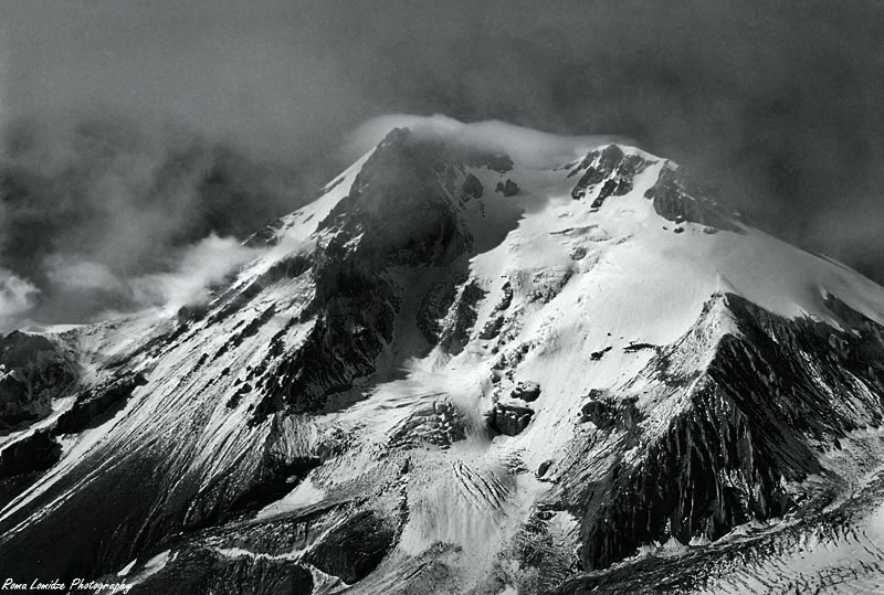 Mount. Kazbek (5068m), Georgia
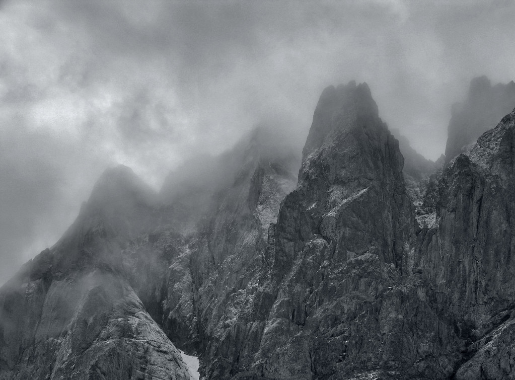 Chaukhi, Georgia
 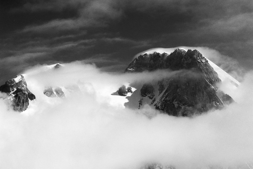 Mount. Kazbek (5068m), Georgia
 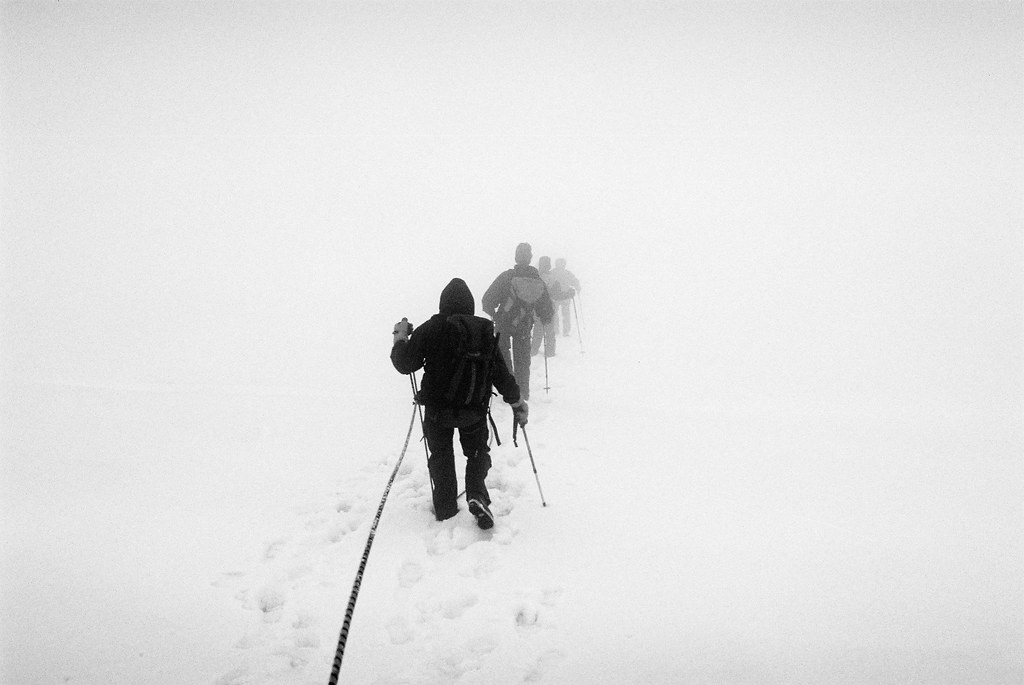 Gegregi Glacier, 4800m, Near Kazbegi, Georgia
Photos by Roma Lomidze (Alpinist, Photographer, Doctor...)
Wednesday, April 30, 2008
PHOTOGRAPHY: The Eagle in Tusheti
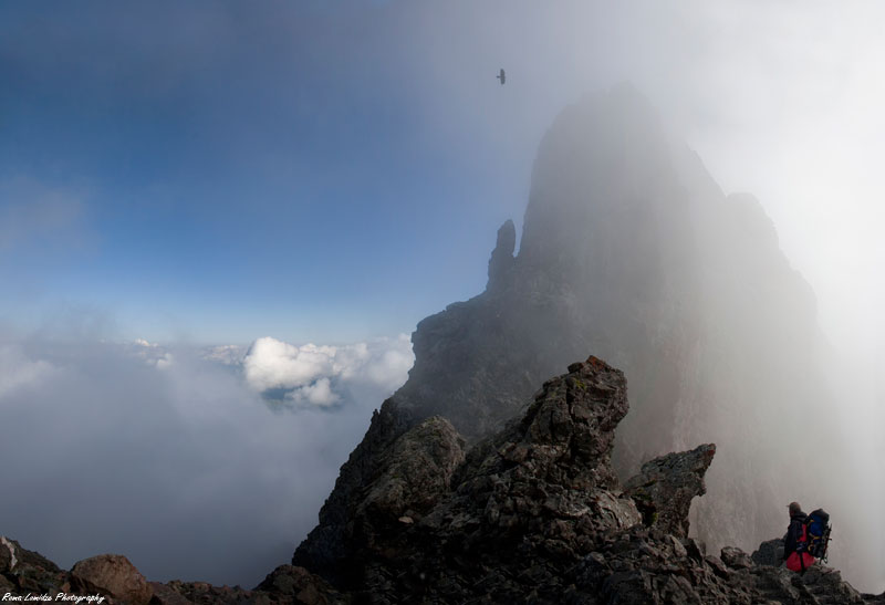 Chaukhi, Stefancminda district, dusheti region, Georgia
Photo: 29. April 2008 von The Alpinist: Roma Lomidze
Thursday, April 24, 2008
CLIMBING ADVENTURE: North Caucasus mountains on Russian-Georgian border.
 ON THE RUSSIAN-GEORGIAN BORDER (AP) -- Tears welled in my eyes twice while hiking some of the most beautiful landscapes on the planet - once in mid-retch gag and once in awe-struck wonder.
They were unexpected bookends for a journey that only vaguely resembled the trip I planned for myself and my hiking partner Ben Yeomans. But that's how adventures often happen in Russia -- unexpectedly, with wonder, bewilderment - and occasionally even nausea. more >>>
If You Go...
TIPS: Russia's North Caucasus is a volatile, corrupt and mind-boggling place, a mix of mindsets that is one part holdover Soviet bureaucracy, one part clan-driven, xenophobic distrust, one part anti-terrorist police policies. The rewards are immense if you have a thick skin, willingness to grease a palm or two, and the patience to weather capricious bureaucracy.
TIMING: For trekking or hiking, September is the best time to go, after the crowds have gone and the weather is cooler. July and August are peak hiking and climbing months. Be prepared for long lines of tourists if you are climbing Mount Elbrus. For skiing, snowboarding or ice climbing, late winter from February on is ideal.
VISAS: Most foreigners will need a visa, obtained well in advance, to enter Russia, and will need to register with authorities upon arrival and have permits for visiting Mount Elbrus, the park and border area. You may want to consult with a travel agent experienced in Russian travel.
GETTING THERE: Most routes involve flying to Moscow's Sheremyetevo or Domodedevo airports; then to Mineralniye Vodi, the city nearest Elbrus; then a three-hour drive south to the Baksan River, the jumping off point for Elbrus.
FOR MORE INFORMATION:
* Mount Elbrus & Caucasus English-language Web site: http://www.elbrus.net/home.htm
* Elbrus National Park administrative offices, ul. Lesnaya, 2 Elbrus Kabardino-Balkariya, phone 011-7-(8)866-387-8141
* Guide services based in Russia: Elbrus Navigator,
* Travel agency based in Ireland with experience in travel to Elbrus region:
Adventure Alternative, http://www.adventurealternative.com/
Sunday, April 13, 2008
REISEN: Kurztour Chewsuretien - Trekking 4 Tage mit Kaukasus-Reisen
Tbilissi-Heerstraße-Kasbegi-Darjalschlucht-Dshuta-Roschka-Barissacho-Tbilissi
- für nur 400 Euro
 Das Bergdorf Dshuta (Juta) im Großen Kaukasus, Georgien
Reisetermine: jederzeit auf Anfrage ab 20.Juni bis 20.September Teilnehmerzahl: 1-6
Reiseprogramm


- für nur 400 Euro
Das Bergdorf Dshuta (Juta) im Großen Kaukasus, GeorgienReisetermine: jederzeit auf Anfrage ab 20.Juni bis 20.September Teilnehmerzahl: 1-6
Reiseprogramm
Tag 1
Abholung Tbilisi, Fahrt entlang der Georgischen Heerstraße über die Festung Ananuri bis zum Kreuzpass (2395 m). Weiterfahrt bis zur Kleinstadt Kazbegi/Stepantsminda auf 1800 m. Wanderung zur Kirche Zminda Sameba mit ihrer beeindruckenden Lage vor dem Massiv des Kasbek (5033 m) Abstecher in die Darjalschlucht bis zur russischen Grenze, Transfer in das chewsuretische Bergdorf Dshuta, Abendessen mit Übernachtung, Vollpension
Tag 2
Frühstück, Wanderung zum Fuß (2550m) des beeindruckenden Chaukhi-Massivs (3700 m) über 2-3 Stunden. Nach Lust und Laune kann man mit etwas Energie einige der umliegenden Bergrücken erwandern. Übernachtung Vollpension
Tag 3
Frühstück. Anspruchsvolle Wanderung nach Roschka mit Picknick über den Chaukhi-Roschka-Pass (ca. 3050 m),
mit 1 Führer und 1 Packpferd, Dauer ca. 8-10 Stunden, je nach Witterung. Eine wunderbare und malerische Tour.
Ankunft in Roschka, Abendessen und Übernachtung
Tag 4
Frühstück, Wanderung nach Barissacho, ca. 2,5 Stunden, Rast und Essen in Korscha, Transfer nach Tbilissi
Reisepreis pro Person: EUR 400.00
Alle weiteren Informationen hier bei Kaukasus-Reisen
Tuesday, April 08, 2008
BLOG: Ein wunderbarer Blog über eine der längsten Wanderungen der Welt !!!!
Gefunden bei Telepolis
Beitrag von Ernst Corinth 06.04.2008
Ein Weblog über einen Fußmarsch von Peking nach Bad Nenndorf
Weblogs gibt es inzwischen so viele wie der sprichwörtliche Sand am Meer. Aber das Blog The Longest Way ist zweifellos eines der interessanteren und fantasiereichsten. Darin beschreibt der 1981 in Hannover geborene Christoph Rehage ein irrwitziges Projekt: Seit vergangenen November ist er zu Fuß unterwegs – von Peking bis nach Bad Nenndorf, dem Wohnort seiner Familie. Dabei führt ihn der etwa 15.000 Kilometer lange Weg durch die Länder Kasachstan, Usbekistan, Turkmenistan, Iran, Armenien, Türkei, Griechenland, das frühere Jugoslawien, Slowenien, Österreich und schließlich Deutschland. Eine Strecke, für die ein Flugzeug nur wenige Stunden benötigt, zu Fuß dagegen dauert es mehr als zwei Jahre.
Beitrag von Ernst Corinth 06.04.2008
Ein Weblog über einen Fußmarsch von Peking nach Bad Nenndorf
Weblogs gibt es inzwischen so viele wie der sprichwörtliche Sand am Meer. Aber das Blog The Longest Way ist zweifellos eines der interessanteren und fantasiereichsten. Darin beschreibt der 1981 in Hannover geborene Christoph Rehage ein irrwitziges Projekt: Seit vergangenen November ist er zu Fuß unterwegs – von Peking bis nach Bad Nenndorf, dem Wohnort seiner Familie. Dabei führt ihn der etwa 15.000 Kilometer lange Weg durch die Länder Kasachstan, Usbekistan, Turkmenistan, Iran, Armenien, Türkei, Griechenland, das frühere Jugoslawien, Slowenien, Österreich und schließlich Deutschland. Eine Strecke, für die ein Flugzeug nur wenige Stunden benötigt, zu Fuß dagegen dauert es mehr als zwei Jahre.
Thursday, January 03, 2008

Monday, August 13, 2007
DEVELOPMENT & NATURE: Tourism Infrastructure Planning in Tusheti National Park of Georgia
Ramaz Gokhelashvili, Alexander Gavashelishvili, Zurab Javakhishvili,
Lela Azniashvili
Georgian Center for the Conservation of Wildlife, GCCW
4 Ambrolauri Str. # 2, Tbilisi 380060, Georgia
E-mail: gccw@ip.osgf.ge
Lela Azniashvili
Georgian Center for the Conservation of Wildlife, GCCW
4 Ambrolauri Str. # 2, Tbilisi 380060, Georgia
E-mail: gccw@ip.osgf.ge
Abstract: This paper provides an example of using biodiversity information for tourism infrastructure and management planning in national parks to avoid conflicts between nature conservation, recreational goals, and other users. Within the area of the proposed Tusheti National Park in Georgia, we used field survey data of seventeen focal species within a GIS analytical environment to assess the consistency of planned management categories zoning and administrative and visitor infrastructure (including tourist trails) with biodiversity conservation requirements. A map, comprised of layers for each focal species, was overlaid onto maps of proposed zoning, infrastructure and tourist trails. Numerous conflicts in planning were detected and recommendations were made to improve zoning and infrastructure planning in the national park, and to minimize negative effects of tourism on biodiversity conservation.
Full Paper >>>
Monitoring and Management of Visitor Flows in Recreational and Protected Areas
Conference Proceedings ed by A. Arnberger, C. Brandenburg, A. Muhar 2002, pages 74-77
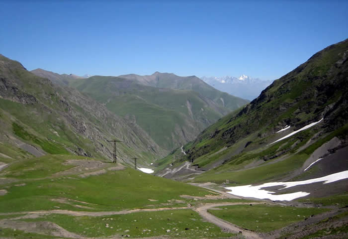
Photo uploaded on August 12, 2007 by Hans Heiner Buhr
great collection of photos from the Guide Hans Heiner Buhr: Tusheti
Travel & Trekking in the Caucasians Mountains of Tusheti >>>
Saturday, June 16, 2007
BOOK: Trekking in the Caucasus (Paperback)
Product details
Paperback: 200 pages
Publisher: Cicerone Press (31 Dec 1993)
Language English
ISBN-10: 185284129X
ISBN-13: 978-1852841294
Product Dimensions: 16.8 x 12 x 1.4 cm
Paperback: 200 pages
Publisher: Cicerone Press (31 Dec 1993)
Language English
ISBN-10: 185284129X
ISBN-13: 978-1852841294
Product Dimensions: 16.8 x 12 x 1.4 cm
Synopsis
Now that the former Soviet Union is open to Western walkers and climbers many are taking the opportunity to visit the fabled Caucasus, the highest mountains in Europe. British climbers knew the area a century ago and, unlike the Alps, the changes have been minimal. 62 walks are described. Some need simple climbing skills but most are straightforward. In addition two routes are described to the tops of Elbruz, the highest mountain in Europe. This is the first modern book of its kind by Russian authors. There are some very easy routes across the Main Range, following good, wide paths, but the fact is that the central part from the Klukhor to Mamisonsky passes cannot offer such a boon. It does not mean you have to climb to get over the Range, but you should not expect a comfortable path up to the saddle and you have to be ready for scree, grass and snow slopes. Not a big hardship, considering the reward in calm and seclusion, so rare nowadays.
Subscribe to:
Posts (Atom)